

| Total Route Length | Approximately 650 miles (Dana Point to Leggett) (California Department of Transportation) |
| Most Scenic Segment | Big Sur corridor (~90 miles, Morro Bay to Carmel) |
| Primary Road Designation | California State Route 1 (SR-1) |
| Typical Full Drive Duration | 4–7 days recommended for the full route with stops |
| Narrowest Section | Big Sur — two-lane road with limited guardrails |
| Closure Risk | Big Sur subject to landslide closures; check Caltrans before travel (Caltrans District 5) |
PCH at a Glance: The Route in Context
California's Pacific Coast Highway — officially SR-1 for much of its length — runs roughly 650 miles along the California coastline, from Dana Point in Orange County up to Leggett in Mendocino County. Most road-trippers drive a curated segment rather than the whole corridor, and the experience shifts dramatically depending on which slice you choose.
| Total Route Length | Approximately 650 miles (Dana Point to Leggett) (California Department of Transportation) |
| Most Scenic Segment | Big Sur corridor (~90 miles, Morro Bay to Carmel) |
| Primary Road Designation | California State Route 1 (SR-1) |
| Typical Full Drive Duration | 4–7 days recommended for the full route with stops |
| Narrowest Section | Big Sur — two-lane road with limited guardrails |
| Closure Risk | Big Sur subject to landslide closures; check Caltrans before travel (Caltrans District 5) |
The highway isn't uniformly breathtaking. Long stretches through suburban beach towns feel more like a busy surface street than a scenic byway. The magic concentrates in specific zones — and knowing those zones in advance separates a frustrating, traffic-snarled crawl from a genuinely memorable journey. If you want to understand what that designation even means officially, our scenic byway explainer breaks down the framework behind those road signs.
Southern Segment: Dana Point to Santa Barbara (~150 Miles)
Starting near Dana Point, the route passes through beach communities — Laguna Beach, Newport Beach, and Malibu — before opening up past Point Mugu. This section is heavily trafficked, particularly on weekends, and Malibu proper can feel stop-and-go on summer afternoons. Don't mistake busyness for blandness, though: the Santa Monica Mountains pressing against the sea make for genuinely dramatic scenery once you're north of the city sprawl.
Past Point Mugu, cliffs drop sharply to the water and the road narrows. This is where many first-timers realize PCH demands actual attention — the guardrails are occasional, the curves are real, and coastal fog can appear without warning. First-time highway drivers should note that PCH isn't a freeway — it's a two-lane state road in significant stretches, with oncoming traffic and limited passing zones.
Santa Barbara marks a natural pause: a genuine city with walkable downtown streets, a working waterfront, and easy accommodation options. Many road-trippers use it as a Day 1 endpoint if driving north from Los Angeles.
Central Segment: Santa Barbara to Carmel (~230 Miles)
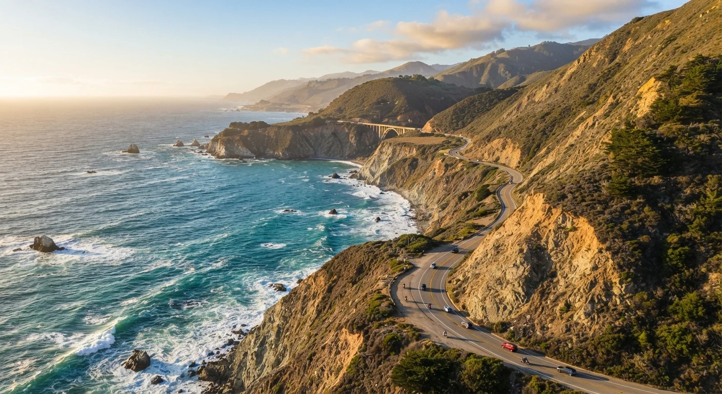
This is the section most people picture when they think of PCH. North of Santa Barbara, the road climbs through Big Sur — roughly 90 miles of coastline where mountains meet the sea with almost no development between them. Highway 1 here is genuinely narrow in places, crosses historic one-lane bridges like Bixby Creek Bridge, and can be temporarily closed after winter landslides. Check Caltrans road condition updates before driving this segment in early spring.
Check Road Conditions Before Big Sur
Highway 1 through Big Sur has a documented history of landslide-related closures, some lasting weeks or months. Before driving this segment, visit the official Caltrans road conditions site (dot.ca.gov) for current status. Detours, when required, can add two or more hours to your drive via US-101 inland. Planning around this possibility is not pessimism — it's smart trip logistics.
San Luis Obispo and the Hearst Castle area (San Simeon) provide a cultural pivot point mid-route. Elephant seal colonies at Piedras Blancas are visible from a roadside pullout — one of the route's genuinely surprising wildlife moments that costs nothing and requires only a 10-minute stop.
Carmel-by-the-Sea is compact, photogenic, and a logical place to spend a night. For context on how this route compares to the Eastern seaboard experience, our East vs. West comparison maps out the cultural and logistical differences.
Northern Segment: Carmel to Leggett (~270 Miles)
Past Carmel, SR-1 passes through Monterey — home to a well-regarded aquarium and a working fishing wharf — before threading up through Santa Cruz. This section is more populated but less heralded than Big Sur, which means lighter traffic and easier parking. The landscape here is gentler: rolling coastal bluffs, agricultural fields, and redwood-fringed hills replacing the sheer drama of the central segment.
North of San Francisco, the highway crosses the Golden Gate and climbs into Marin County. Stinson Beach, Point Reyes National Seashore, and the Sonoma and Mendocino coastlines offer dramatic scenery that rivals Big Sur in beauty but attracts a fraction of the visitor volume. The road eventually ends where SR-1 merges with US-101 at Leggett, deep in redwood country.
For travelers drawn to lesser-known coastal corridors, the Gulf Coast route offers a genuinely different flavor — history-rich, flat, and deeply regional in character.
What First-Timers Most Often Overlook
A few practical realities catch new PCH drivers off-guard:
- Fog timing: Morning fog is common along the entire route, especially in summer. Plan to leave late morning and catch golden-hour light in the afternoon.
- Gas gaps: Big Sur has very few services. Fuel up in San Luis Obispo or Carmel before entering the corridor — don't assume a station is around the next bend.
- Pullout etiquette: Designated turnouts exist for a reason. Stopping in the travel lane for photos is both illegal and genuinely dangerous.
- Driving duration vs. mileage: 100 miles on PCH can take three to four hours with stops, terrain, and traffic. Don't plan distances the way you would on an interstate.
- Seasonal closures: Landslides have closed portions of the route for extended periods in the past. Always verify current Caltrans conditions before departure.
SR-1 (State Route 1)
The official California highway designation for the majority of the Pacific Coast Highway. It is a state-maintained two-lane road along most of its coastal length, distinct from federal interstates.
Turnout
A designated roadside pullout area where drivers can safely stop, park briefly, and take in views or check maps without obstructing traffic flow.
Caltrans
The California Department of Transportation, responsible for maintaining state highways including SR-1. Caltrans publishes real-time road conditions and closure notices.
Coastal Fog (June Gloom)
A recurring weather pattern along the California coast where marine layer clouds and fog persist through morning hours, particularly in late spring and early summer.